UN
6 Heath Road
£ 267,500
Description
We don't have a Description for this property.
- Bedrooms
- 3
- Bathrooms
- 0
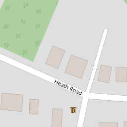

Leaflet © OpenStreetMap contributors
The heatmap indicates the level of crime in the area. The color of the heatmap indicates the crime severity and recency.
Metrics Year-on-Year
- Average area value
- 423,102.00 £Decreased by 10.77 %
- Average area rental value
- 1,150.00 £/moDecreased by 38.67 %
- Est rental Yield
- 3.26 %Decreased by 31.37 %
- Crime Rate
- 3.00 %Unchanged by 0.00 %
from 474,146.00 £
from 1,875.00 £/mo
from 4.75 %
from 3.00 %
Nearby Schools
| Name | Type | Ofsted | Distance |
|---|---|---|---|
| Locks Heath Junior School | Community School | Good | 0.71 KM |
| Locks Heath Infant School | Community School | Outstanding | 0.82 KM |
| Lws Academy | Academy Special Converter | Requires improvement | 1.09 KM |
| Brookfield Community School | Community School | Good | 1.10 KM |
| Sovereign And Strawberry Meadow Children'S Centre | Children's Centre | 1.12 KM |
Images
Nearby Streets
| Name | Average Price | Average Sqft | Distance |
|---|---|---|---|
| Centre Way | £ 0 | 0 | 0.00 KM |
| Lavender Grove | £ 0 | 0 | 0.00 KM |
| Highfields | £ 775,000 | 0 | 0.00 KM |
| Deacon Road | £ 525,000 | 0 | 0.00 KM |
| Dibles Road (East) | £ 491,667 | 0 | 0.00 KM |
Nearby Transport
| Name | NLC | TLC | Distance |
|---|---|---|---|
| Swanwick | 5920 | SNW | 1.93 KM |
| Bursledon | 5927 | BUO | 4.14 KM |
| Hamble | 5947 | HME | 6.06 KM |
| Botley | 5894 | BOE | 6.42 KM |
| Netley | 5911 | NTL | 7.52 KM |
Nearby Listings
| Address | Price | Type | Score | Distance |
|---|---|---|---|---|
| St. Michaels Road, Locks Heath, Southampton, Hampshire, SO31 | £ 325,000 | BUY | 7 / 10 | 0.19 KM |
| Raley Road, Locks Heath, Southampton | £ 475,000 | BUY | 6 / 10 | 0.21 KM |
| Lydney Road, Locks Heath SO31 | £ 439,995 | BUY | 6 / 10 | 0.21 KM |
| Danehurst Place, Locks Heath | £ 999,950 | BUY | 7 / 10 | 0.24 KM |
| Exeter Close, Locks Heath, Southampton, Hampshire, SO31 | £ 450,000 | BUY | Unknown | 0.24 KM |
Nearby Properties
| Address | Price | Distance |
|---|---|---|
| 66 Heath Road | £ 247,500 | 0.00 KM |
| 42 Heath Road | £ 422,500 | 0.00 KM |
| 14 Heath Road | £ 310,000 | 0.00 KM |
| 64 Heath Road | £ 350,000 | 0.00 KM |
| 76 Heath Road | £ 168,055 | 0.00 KM |